Fossils are often discovered in one place but formed in another, carried across the planet by tectonic plates over millions of years. Reconstructing that earlier location usually demands specialist software, model knowledge and careful handling of geological data.
A new open-access tool from the University of Barcelona aims to make that process far easier.
The Paleocoordinates Calculator, known as PACA, converts present-day fossil coordinates into estimated positions from deep time. Users can upload a CSV file containing modern longitude, latitude and geological age, then receive reconstructed paleocoordinates within seconds.
The BIOST3 Research Group developed the tool and described it in the journal Scientific Reports. The team included Noa Scholz-Murcia, Alejandro Rodríguez-Mena, Víctor Madarnás-Gómez and Antonio Monleón-Getino from the university’s Faculty of Biology.
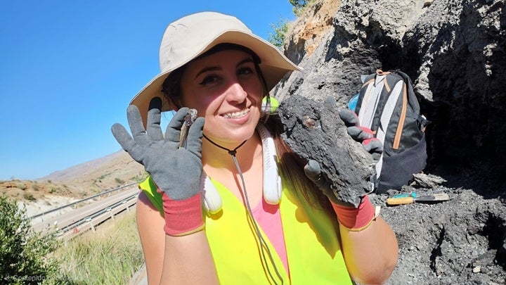
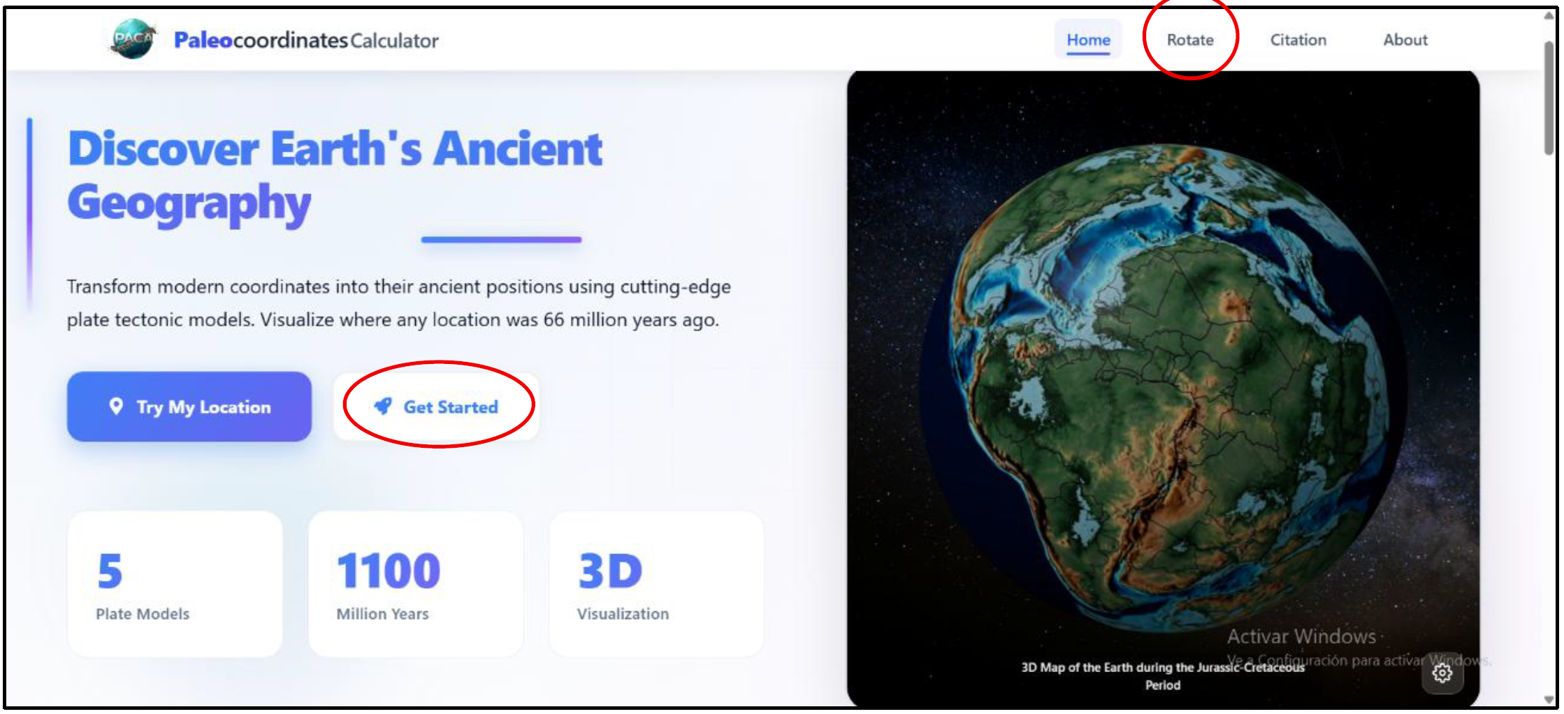
Unlike traditional tectonic reconstruction programs, PACA does not require users to write code or install specialized desktop software. It provides a browser-based interface connected to established global plate models already used by Earth scientists.
PACA relies on the palaeoverse package in the R programming language. That package connects to the GPlates Web Service, which applies mathematical rotations describing how tectonic plates moved across Earth’s surface.
“This innovative interface removes methodological barriers: you simply upload a CSV file containing the current coordinates and the geological age of the find to obtain the exact paleocoordinates in seconds,” said Professor Antonio Monleón-Getino, head of the BIOST3 Research Group and a member of Bioinformatics Barcelona.
The uploaded file must include a record name, modern longitude and latitude, plus minimum and maximum ages in millions of years. PACA calculates the arithmetic mean of that age range and uses it as the reconstruction date.
That approach gives each fossil or sampling point one representative age. It does not capture the full temporal uncertainty of a wide age range. Users can test the earliest and latest positions separately by entering the same value in both age fields.
The interface uses the more precise “point” reconstruction method rather than a pre-calculated grid. Each location is rotated individually through the GPlates service, avoiding the spatial averaging of a grid with roughly 100-kilometre spacing.
No single reconstruction model can perfectly describe the movement of every plate through geological time. Models use different evidence, assumptions and reference frames, leading to variations in their predicted positions.
PACA allows users to compare five models at once: PALEOMAP, GOLONKA, MERDITH2021, TorsvikCocks2017 and MATTHEWS2016_pmag_ref.
“The tool allows users to compare their data simultaneously with up to five global plate models widely used by the scientific community,” said Scholz-Murcia, the article’s first author and a member of the University of Barcelona’s Biodiversity Research Institute.
For every location, PACA calculates the paleolatitudinal range between model predictions. It also reports the greatest geographic distance, in kilometres, between any two reconstructed positions.
Those measurements show where tectonic uncertainty is small and where interpretations deserve caution. A fossil may remain within the tropics under every model, for example, or shift between climate zones depending on the reconstruction.
Researchers could compare that variability with extinction patterns, species distributions or ancient climates. Large differences may point to regions with complicated tectonic histories or limited geological evidence.
The results appear in a searchable table and can be downloaded as a CSV file for statistical analysis. PACA places each model reconstruction in a separate row, making comparisons easier.
The interface also includes an interactive three-dimensional viewer developed with React and Blender. Reconstructed points can be projected onto paleogeographic maps from Christopher Scotese’s PALEOMAP Project.
Each globe corresponds to a geological period defined by the 2024 International Chronostratigraphic Chart. Users can also export the visualization as a GLB file for other 3D software.
The source code, conversion scripts and visualization files are publicly available through Zenodo. That archive supports reproducibility and provides a reference if the underlying web services or tectonic models change.
PACA does not introduce a new theory of plate motion. Instead, it provides easier access to existing models while preserving information about which model was used and when the reconstruction occurred.
The team compared PACA with the traditional GPlates desktop workflow using fossil sites distributed worldwide and spanning a broad range of geological ages.
The final validation included 142 successful reconstructions. Median spatial errors ranged from 6.25 metres to 16.8 metres across the five models.
On a planetary scale, those differences were negligible. Global tectonic reconstructions commonly contain uncertainties measured in tens or hundreds of kilometres.
The concordance correlation coefficient reached 1.000 for every model, indicating almost perfect agreement between PACA and the desktop calculations. Statistical tests found no evidence of systematic bias.
Several attempted reconstructions failed because fossil ages extended beyond a model’s time limits or involved plates that were not defined at those ages. The same cases failed in the desktop software, showing that the gaps came from model limitations rather than PACA.
One additional case was excluded because a plate had been assigned manually despite the point sitting slightly beyond its boundary. That decision produced a distortion of about 2,000 kilometres, illustrating how manual assignments can affect results.
The validation also exposed possible version differences in rotation files. The researchers achieved consistency with an earlier paleomagnetic reference version of one model, while newer files produced substantial longitudinal shifts.
PACA could make paleogeographic analysis available to researchers, teachers and students who lack programming experience or access to complex desktop workflows. It can process large datasets while keeping the reconstruction method visible and reproducible.
The tool may help palaeontologists place fossil discoveries in their original geographic settings, compare ancient species ranges and examine whether organisms crossed climate zones or tectonic boundaries.
Its model-comparison features also encourage users to treat reconstructed locations as estimates rather than fixed points. That distinction matters when plate histories remain uncertain or models produce widely separated positions.
The authors caution that PACA depends on the live GPlates Web Service. Future updates to its rotation files could slightly change results. They recommend recording the access date, selected model and reconstruction age while preserving the downloaded CSV as the permanent record.
By combining established tectonic models, automated calculations and 3D visualization, PACA lowers a major technical barrier without sacrificing the mathematical accuracy of the traditional workflow.
Research findings are available online in the journal Scientific Reports.
The original story “New PACA mapping tool tracks fossil locations back through millions of years” is published in The Brighter Side of News.
Like these kind of feel good stories? Get The Brighter Side of News’ newsletter.
The post New PACA mapping tool tracks fossil locations back through millions of years appeared first on The Brighter Side of News.