A satellite constellation can measure distances between its members with extraordinary precision and still gradually lose track of which way it is pointing.
Researchers have now shown how the Moon could solve that problem.
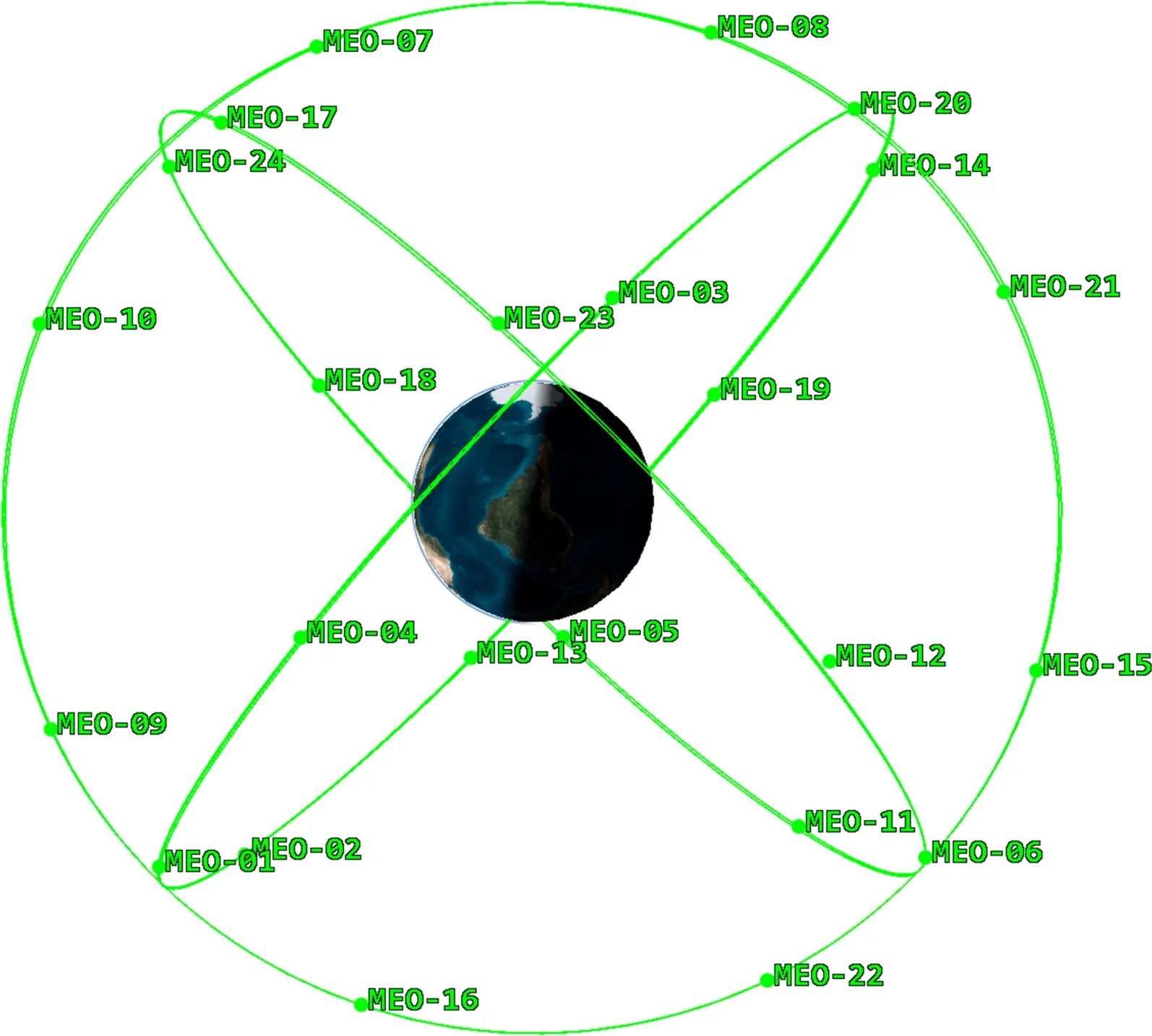
A team led by scientists at the Chinese Academy of Sciences connected a simulated four-satellite lunar navigation constellation to 24 operational BeiDou-3 satellites. Over a 60-day experiment, the lunar satellites effectively anchored the orientation of the Earth-orbiting network and prevented the steady drift that otherwise degraded its autonomous navigation accuracy.
The study, published in Satellite Navigation, combined real inter-satellite ranging observations from BeiDou-3 with simulated Earth-Moon and lunar measurements. The result suggests that future navigation infrastructure around the Moon could do double duty, supporting lunar exploration while making Earth-based satellite navigation more resilient.
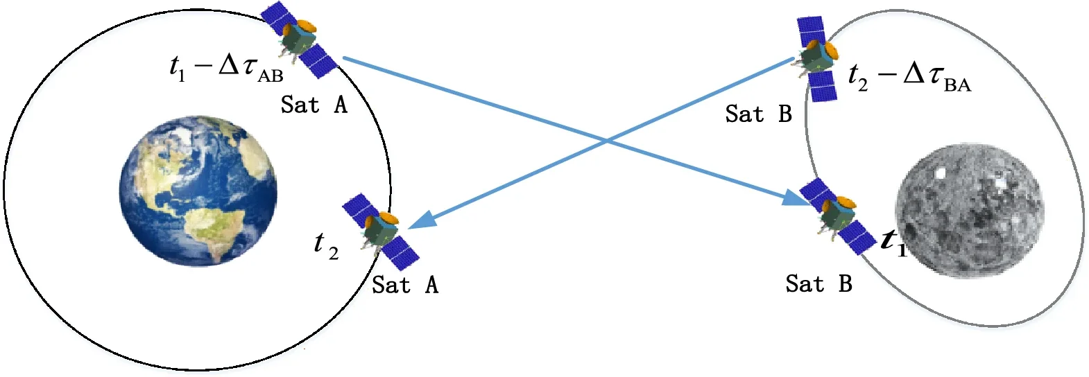
Global Navigation Satellite Systems such as BeiDou, GPS and Galileo normally depend on ground stations to calculate precise satellite orbits and regularly upload updated information.
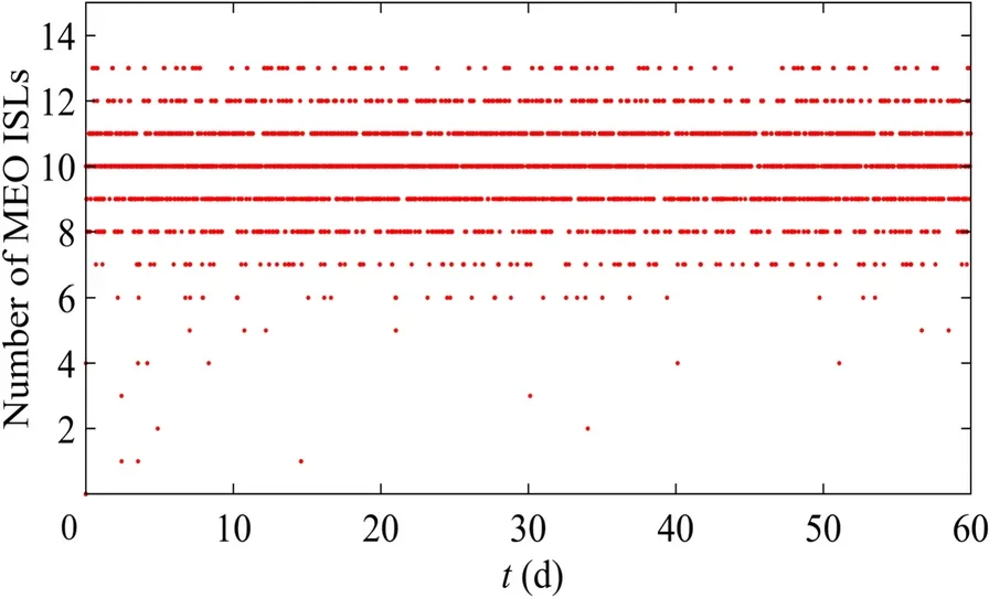
Autonomous orbit determination offers an alternative. Satellites measure their distances from one another using inter-satellite links and collectively estimate their own positions without continuous ground support.
That independence could be particularly valuable if ground communications were interrupted or unavailable. Yet the technique has a fundamental weakness: measurements between satellites reveal their relative geometry but cannot fully determine the absolute orientation of the entire constellation.
Imagine a rigid constellation being rotated slightly as a single object. The distances between its satellites remain unchanged. Pure inter-satellite ranging therefore cannot easily tell that the rotation occurred.
This creates what researchers call constellation rotation error. In particular, the right ascension of the ascending node, which describes an orbit’s orientation in space, becomes poorly observable. Small errors can then accumulate as the autonomous system operates for days or weeks.
Existing methods constrain the drift using predicted orbital parameters, but predictions themselves become less accurate with time.

Xia Lin, Baojun Lin and their colleagues approached the problem by extending the navigation network far beyond Earth.
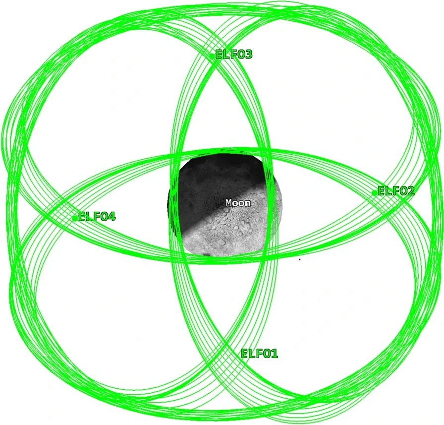
They combined 24 BeiDou-3 Medium Earth Orbit satellites with four spacecraft in elliptical lunar frozen orbits, or ELFOs. These elongated lunar trajectories are designed to remain comparatively stable while offering strong coverage around the Moon’s polar regions.
The crucial difference is gravity.
BeiDou satellites primarily move under Earth’s gravitational influence. Lunar ELFO spacecraft operate in a very different dynamical environment in which the Moon’s gravity strongly controls their motion.
That breaks the symmetry responsible for the orientation ambiguity. If the entire network is rotated incorrectly, Earth-orbiting and Moon-orbiting spacecraft no longer respond to the gravitational environment in the same way.
Connections spanning Earth and the Moon therefore supply information that ordinary Earth-to-Earth satellite ranging lacks. The Moon effectively becomes part of the reference system.
The researchers quantified the change using an information-matrix condition number, a mathematical measure of how well the satellite positions can be determined. With the 24 BeiDou satellites alone, values remained around 10^15 to 10^18, essentially representing a rank-deficient problem. Adding four lunar spacecraft lowered the condition number to approximately 10^2, indicating a much better constrained solution.
The researchers tested three navigation scenarios from October to December 2020.
The first allowed the 24 BeiDou satellites to determine their orbits from inter-satellite measurements without correcting the constellation’s rotational drift. The second used the conventional method of constraining that rotation with predicted orbital parameters. The third connected BeiDou with the four simulated ELFO satellites.
Without a correction, accuracy steadily deteriorated. By day 60, the mean user range error across the BeiDou constellation reached 7.85 meters.
Prediction-based correction dramatically improved performance, limiting the error to about 0.60 meters after 60 days. Even that solution continued to show slow degradation as the predicted orientation became less accurate.
The Earth-Moon configuration behaved differently. Its errors remained bounded rather than drifting continuously, with the maximum daily mean user range error reaching just 0.35 meters during the entire experiment.
Rotational errors showed the same pattern. In the uncorrected case, biases reached approximately 304 milliarcseconds around one axis. Prediction-based correction reduced the largest values to about 18 milliarcseconds.
With the lunar satellites included, maximum rotational biases remained at 13.59, 10.27 and 4.04 milliarcseconds along the three measured axes.
The arrangement did not simply improve BeiDou. The joint calculation also determined the positions of the four simulated lunar satellites.
Their maximum radial error remained below 0.16 meters. Along-track and cross-track deviations stayed below roughly 1.7 and 1.8 meters, respectively, while maximum three-dimensional position error remained under 2.3 meters.
That two-way benefit could become important as governments and private companies construct lunar communications and positioning systems.
ESA’s Moonlight program is developing a lunar communications and navigation service intended to support spacecraft and surface missions, particularly around the Moon’s south pole. NASA’s LunaNet framework similarly envisions interoperable communications and positioning services for a growing network of lunar missions.
ELFO configurations have attracted interest because their geometry can provide useful polar coverage with relatively modest station-keeping requirements.
A connected Earth-Moon navigation architecture could therefore allow infrastructure built primarily for lunar users to improve autonomous navigation closer to Earth as well.
The study has an important limitation. The BeiDou inter-satellite measurements were genuine operational data, but the lunar spacecraft and their radio links were simulated.
Earth-Moon link measurements were assigned realistic noise and communication constraints, but actual hardware will introduce additional complications. Antenna errors, clock behavior, thermal effects, radiation, imperfect force models and communication outages could all influence real-world performance.
The authors plan to replace simulated lunar observations with spacecraft measurements once suitable missions become operational. Future work must also balance orbit determination with the need to provide continuous positioning, navigation and timing services to lunar users.
Even with those caveats, the study illustrates an unusual advantage of expanding navigation infrastructure toward the Moon. A satellite system built hundreds of thousands of kilometers away could provide more than directions for astronauts and lunar rovers.
It could also give navigation satellites around Earth something they cannot obtain merely by measuring one another: a stable sense of which way they are facing.
These studies and resources explore the emerging technologies behind autonomous orbit determination, lunar satellite constellations and interoperable cislunar navigation.
Autonomous orbit determination for lunar navigation constellation using low Earth orbit satellites: This study links low-Earth-orbit spacecraft with lunar satellites in ELFO and distant retrograde orbits, demonstrating meter-scale autonomous lunar orbit determination and time synchronization. (Advances in Space Research, 2026)
A Novel Orbit Determination and Time Synchronization Architecture for a Radio Navigation Satellite Constellation in the Cislunar Environment: Researchers developed an ESA-supported architecture for autonomous orbit and clock estimation in a four-satellite ELFO lunar navigation constellation. (NAVIGATION, 2025)
Autonomous orbit determination, timekeeping and service performance analysis of the cislunar space navigation system based on special long-period orbits: This work evaluates autonomous positioning and time synchronization for a cislunar navigation system using inter-satellite measurements. (Measurement, 2025)
ESA launches Moonlight to establish lunar communications and navigation infrastructure: ESA outlines its Moonlight program for providing dedicated navigation and communications services to future robotic and human missions around the Moon. (European Space Agency, 2024)
LunaNet Interoperability Specification: NASA’s current interoperability framework defines standards for communications and positioning, navigation and timing services supporting missions traveling to, around and on the Moon. (NASA, 2025)
Research findings are available online in the journal Satellite Navigation.
The original story “The Moon could solve a stubborn GPS navigation problem for satellites around Earth” is published in The Brighter Side of News.
Like these kind of feel good stories? Get The Brighter Side of News’ newsletter.
The post The Moon could solve a stubborn GPS navigation problem for satellites around Earth appeared first on The Brighter Side of News.


Leave a comment
You must be logged in to post a comment.